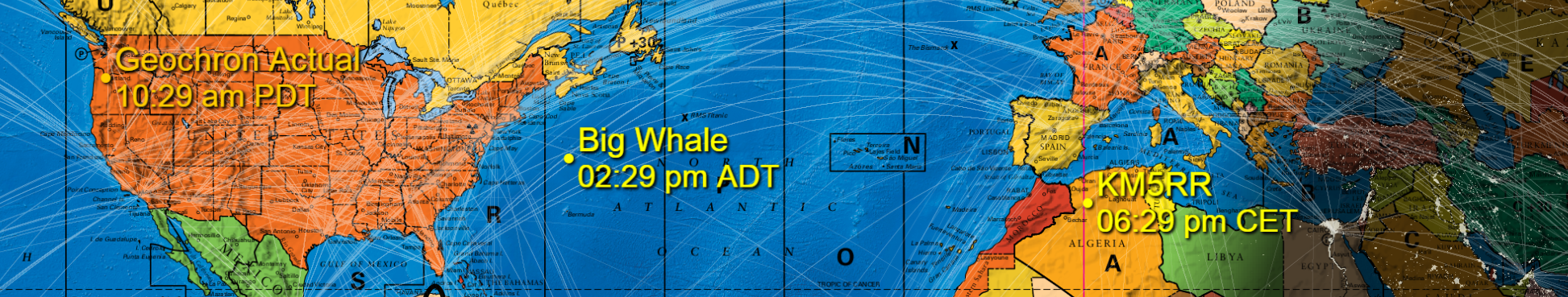
See the Grey Line in Real Time 4k.
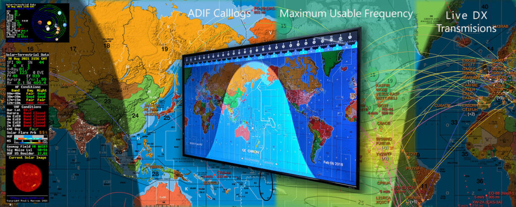
Live DX, FT8, and WSPR Spotting*
See propagation in real time worldwide to estimate your transmission bands.
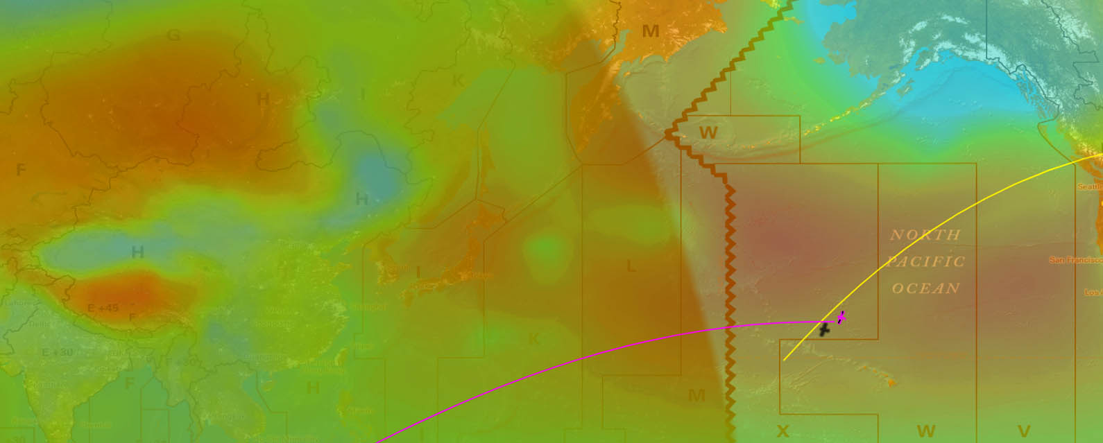
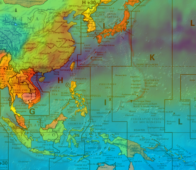
Maximum Usable Frequency*
Live MUF maps show where the ionosphere is crackling with solar energy.
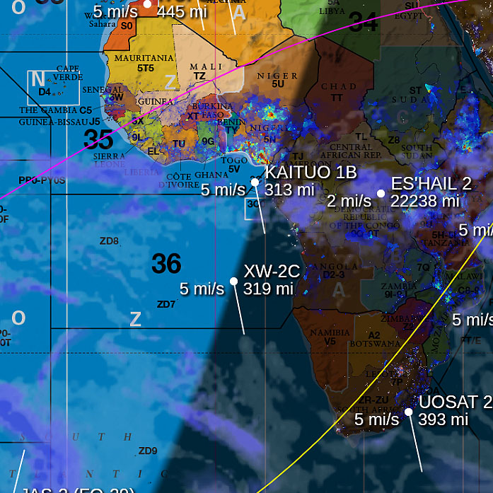
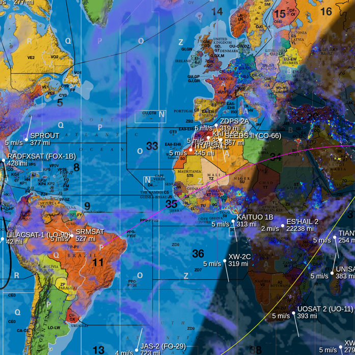
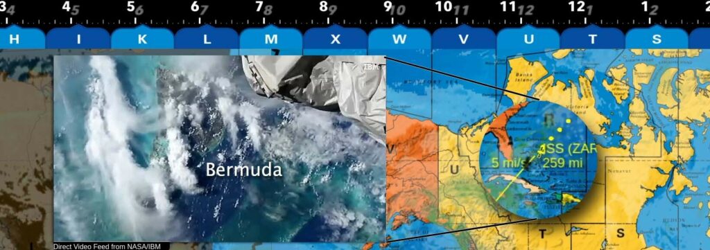
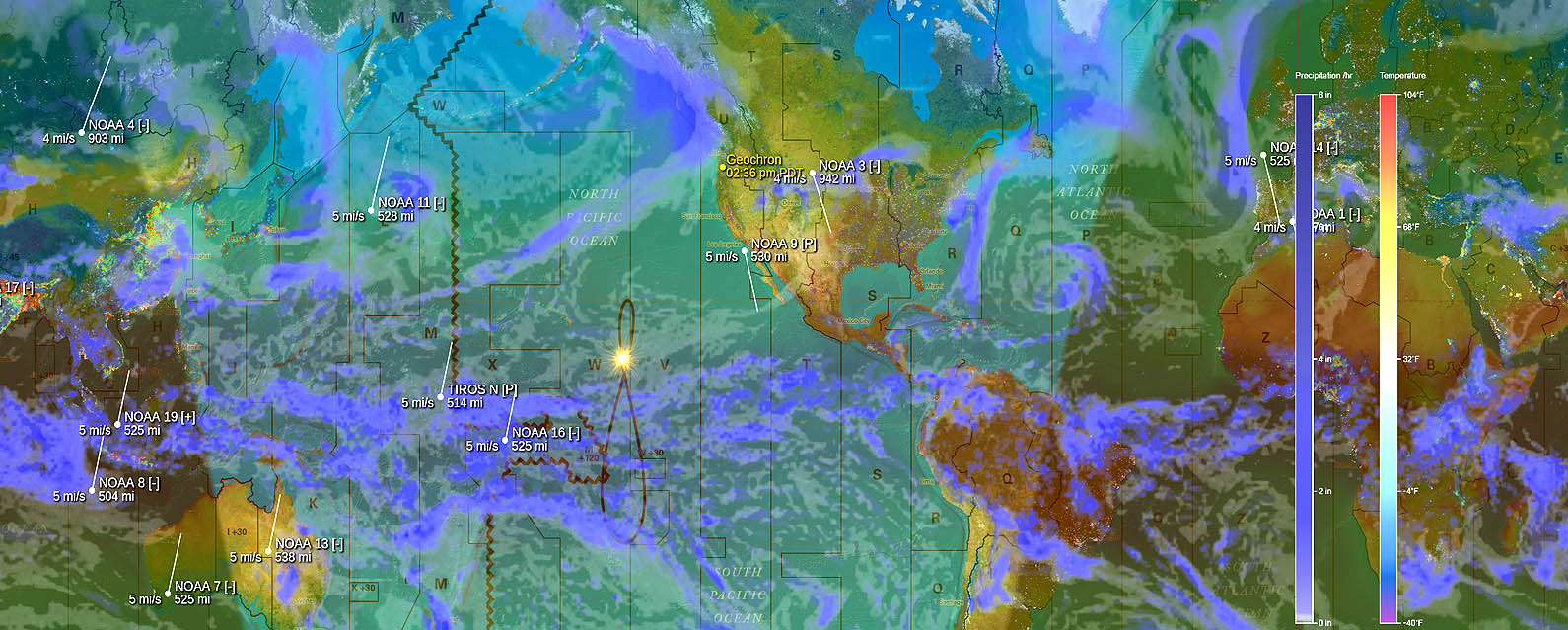
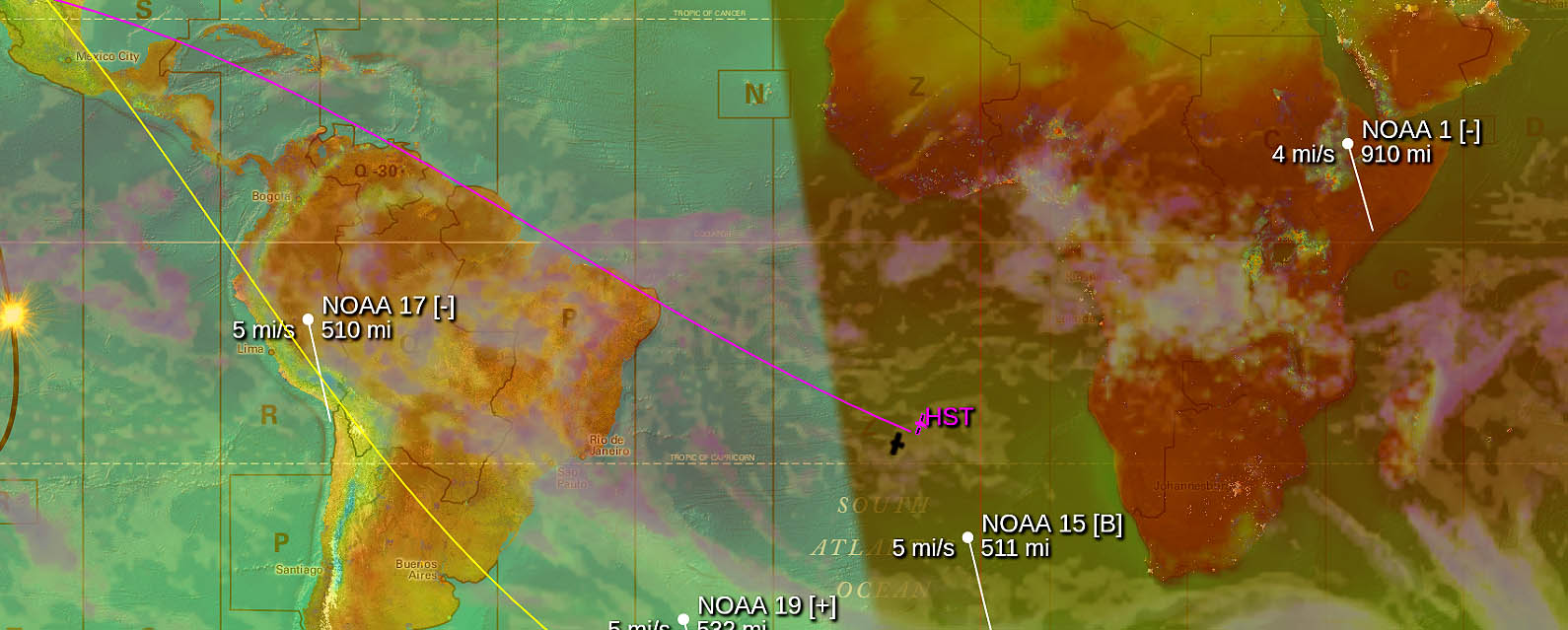
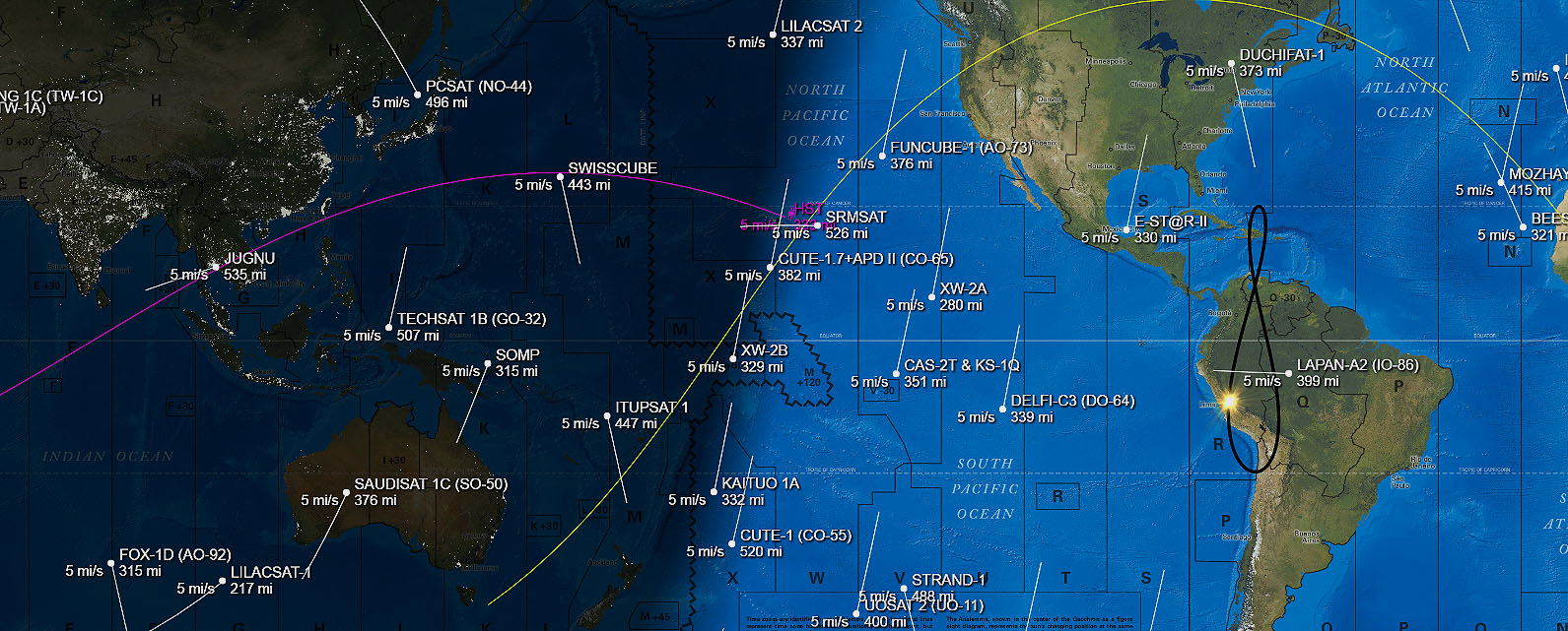
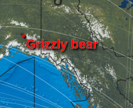
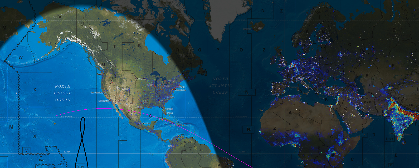
AMSAT Satellite tracking and footprint*
Active FM and Linear A/R satellites tracking with terrestrial footprints.
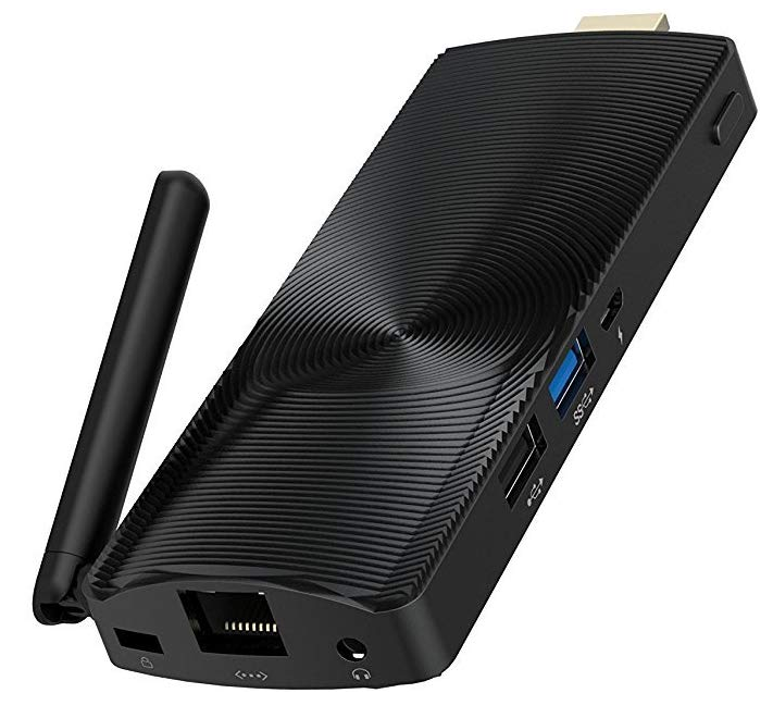
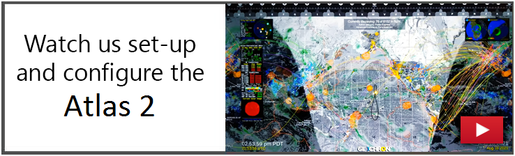
Easy Setup
Plug in the HDMI cable, grab the remote, and turn it on. Internet enables more features. Watch Set-up Process…
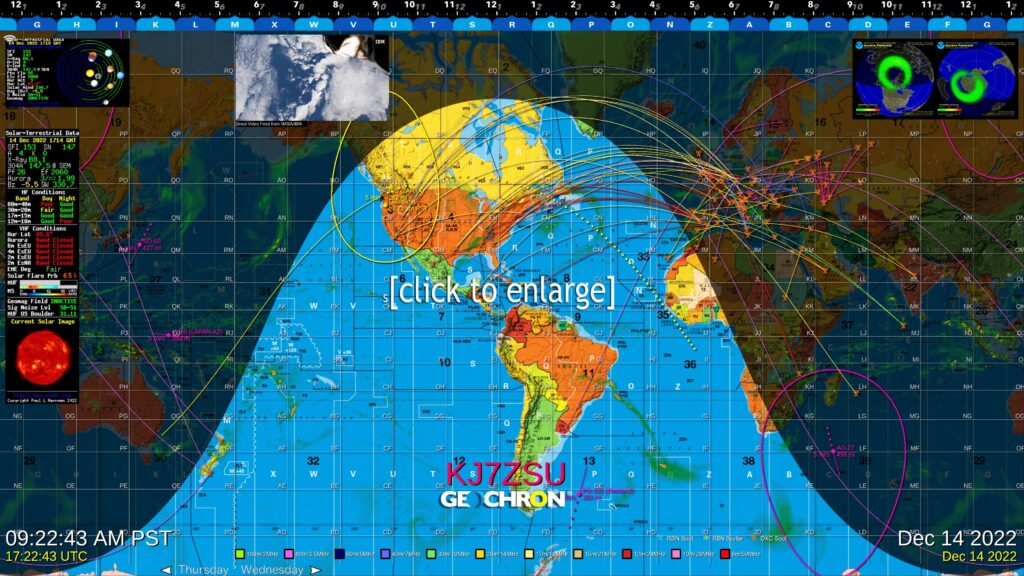
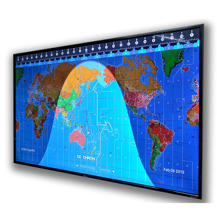
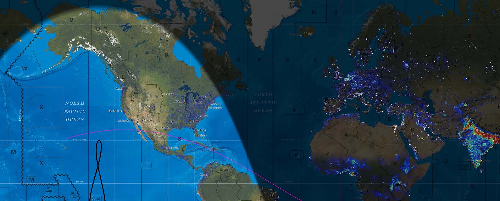
The Grey Line in real time
Solar sunrise and sunset move across the map over ITU regions and international prefixes with a fixed or geo-centric projection.
Dynamic Overlays
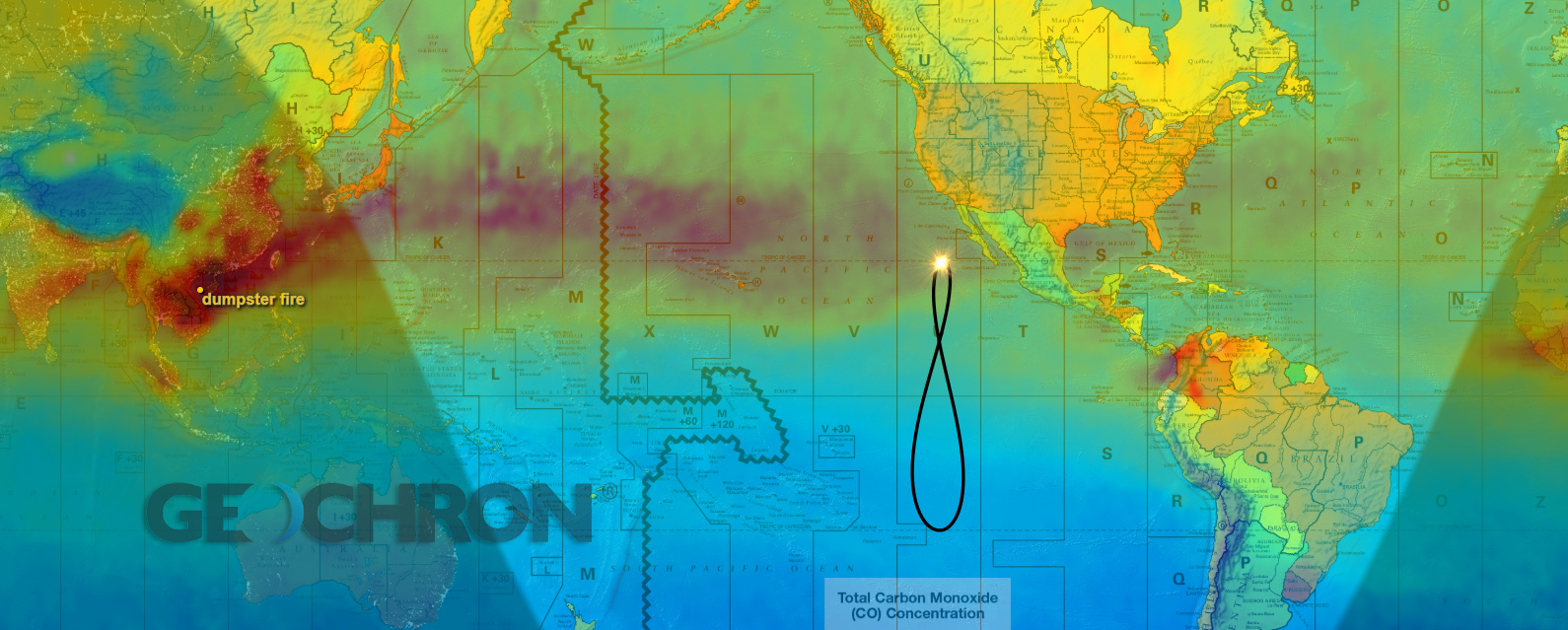
Earth Lights at night, major transportation routes, pollution and population. Learn more…
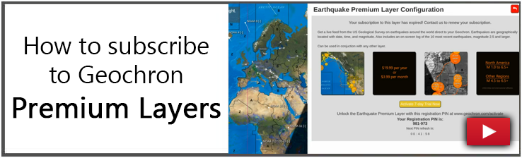
* Part of the Ham Radio Premium Bundle, available on Atlas platforms.
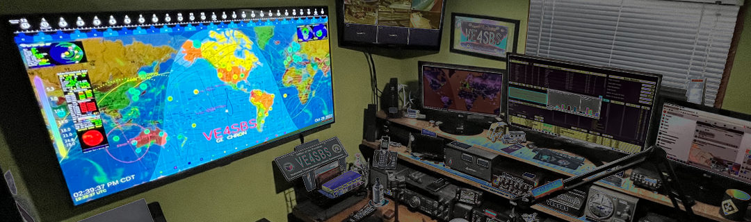
A Worldview in 4K with Live DX, Call logs, MUF, and Solar Weather
The Geochron Digital Atlas 4K gives viewers beautiful displays of the Earth with Amateur Radio real time data through a small computer that plugs directly in to your TV via HDMI. The size of your display is only limited by the size of your TV, as you can see Amateur Radio activity around the world at glance.
(How is this different from previous versions of Geochron Digital?)
The Geochron Digital Atlas 4K displays a full-featured Geochron World Clock on any 4K TV, with every mapset and lighting option available in our famous mechanical clock but at a fraction of the cost. Now in the digital format, users can customize markers on the map, and receive (with internet) real time updates. The hardware is a sturdy, fanless mini computer specifically designed for commercial digital displays found in restaurants and airports.
Included with our Ham Radio Bundle:
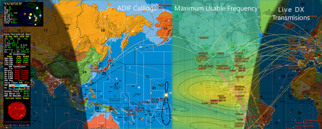
- Live DX Propogation, updated every 10 minutes by band.
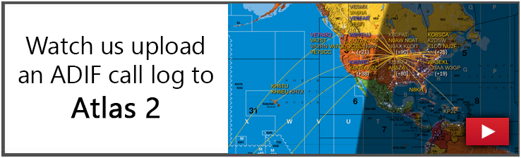
- ADIF Call Log display, easily uploaded through Geochron.com
- Maximum Usable Frequency, in topographic and heat map overlays.
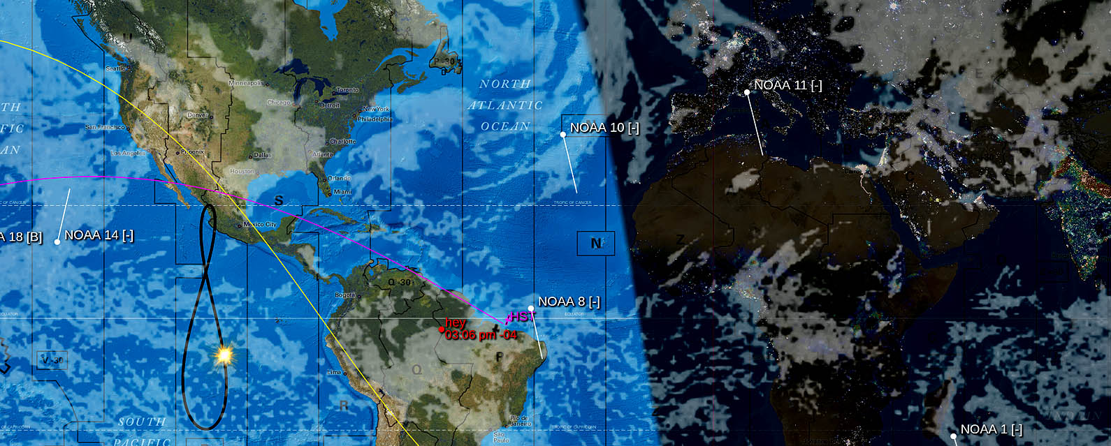
- AMSAT Satellite Tracking, with selectable footprint.
- Maidenhead Grid, for contesting.
- Solar and Aurora Data, directly on the display.
- Call Sign Display, with adjustable font and color over the Geochron logo.
Also includes at no charge, live displays of:
- Global Satellite Weather overlays, including*
- Precipitation
- Wind Speed
- Barometric Pressure
- Temperature
- Cloud Cover
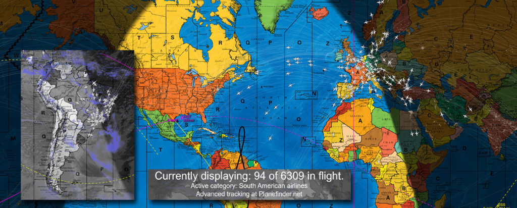
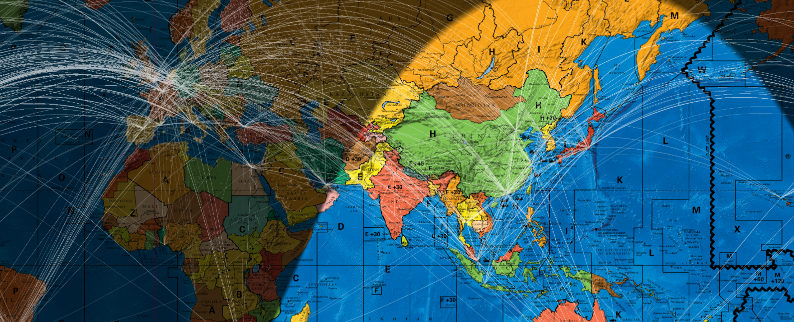
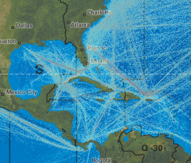
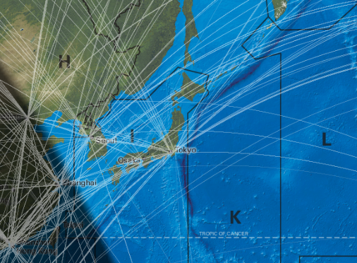
- Commercial Aviation. Watch up to 500 flights in real time categorized by continent of origin (Asia, N.America, S. America, Europe, and Africa), or rotate between them all.*
- COVID-19. See a country-by-country graphic of COVID cases and deaths, updated daily through the Johns Hopkins world database.*
- Greyscale options for all mapsets for better Live Layer visibility.
- Lifetime updates for five mapsets.
- Geopolitical with Human Points of Interest
- Geopolitical with Oceanic Points of Interest
- Topographical “A view from space.”
- Ham / Amateur Radio mapset
- Low Resolution (1080) Geopolitical mapset.
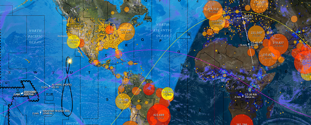
- Live location of the International Space Station and over 400 satellites, updated every second.*
- High Speed demonstration mode. One year in 15 seconds!
- Layer Demonstration mode. Automatically cycle through layers at selected time intervals, so your display never looks the same.
- Sixteen Locations Pins with custom text names and local time that you can place anywhere on the map.
- Static Overlays, showing:
- Premium Live Displays:
- Digital Time Accuracy to within 500 milliseconds*, and on-the-fly time adjustments to local time zones. Simultaneous UTC with Local time readout.
- Automatic Night Dimming by your location.*
* with internet connection
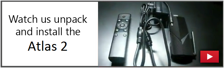
Easy Setup
Although the algorithms behind the dynamic display are complex, the Geochron Atlas 4K is ready to go out of the box. It’s easy to set up and use with the provided remote control, and – with an internet connection – includes time and date configuration, firmware updates, and map updates.
- Included:
- 3′ Power Supply 110-220v USA Plug, required for power. (USB power?)
- 1′ HDMI Cable, male to female, to conveniently mount behind the display. (more details)
- Remote Control and AAA batteries
- Quick Start Documentation
- One Year Warranty
- New Updates as available with Internet.
- Not Included:
- 4K TV (Can I use a 1080 HD Tv? and What about screen burn-in?)
- Internet connectivity
- Shipping:
- One business day handling.
- USPS Priority Shipping, or UPS
- Please contact us for overseas shipping.
- Requirements
- Internet is necessary for real-time layers.
- 110 to 220v power.
- 4K Display screen recommended, larger than 28 inches.
- Default USA Plug
Not every one has $2,000 to $4,000 for the beautiful mechanical Geochrons made since 1964. Many Geochron enthusiasts have waited for years for an affordable option in the digital world, and this is it: everything the mechanical Geochron can do, plus customizable settings, multiple maps, live updates, and as big as you want.
Showing Earth at Night Layer

Installations


Buy Now!
Layers over the mapset interact with a dynamic world
We are constantly adding new layers over the beautiful mapsets Geochron is known for. Layer and map updates are free for all Geochron Digital 4k’s, but require an internet connection to download to the computer on command.
11/2022: International Space Station LEV (premium)
08/2021: Ham Radio Bundle (premium)
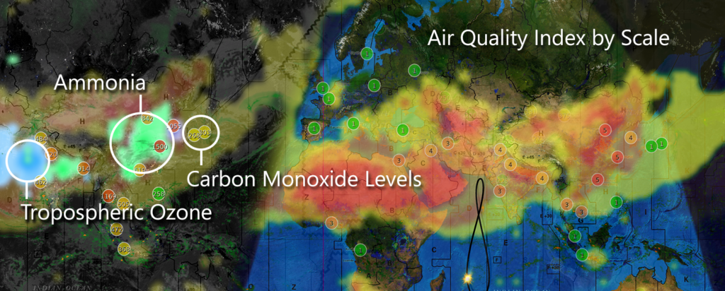
02/2022: Air Quality Monitoring globally and by city, with mini-maps (premium)
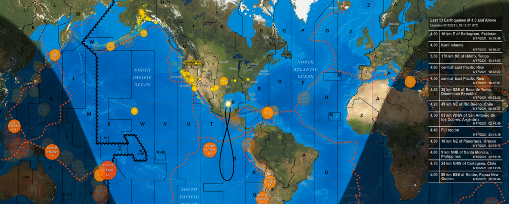
07/2021: Earthquake Layer (premium)
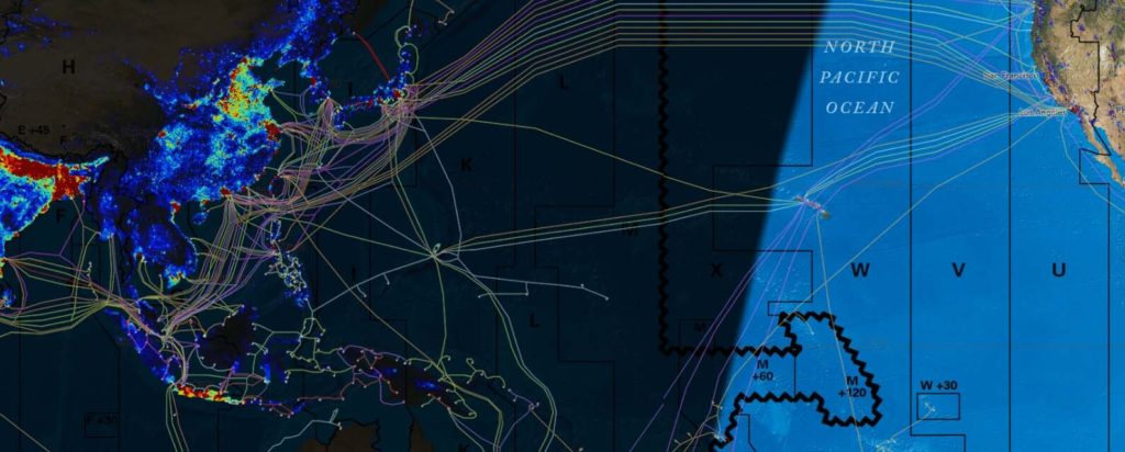
02/2021: Undersea/Submarine Data Cables
11/01/2020: Commercial Aviation Tracking by category
07/24/2020: COVID-19 Statistics. Current infections (Total Mortality)
05/01/2019: Live weather overlays
11/25/2018: Population heat map overlay
10/22/2018: Satellite tracking and trailing vectors
08/15/2018: Local Time shown at Location Pins
06/12/2018: Carbon Monoxide Pollution over Human Geopolitical
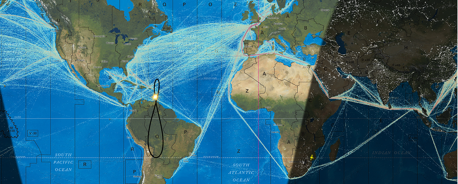
Major Air Routes over Oceanic Geopolitical
Major Sea Routes over Topographical
A full changelog since April 2018
Standard Mapsets


Technical Details and Features
The deepest dive is our technical changelog.
A description of all the features in our Ham Radio Bundle.


Six Frequently Asked Questions, like “Why isn’t this an app?“
Digital Geochron v. Mechanical feature chart
Geochron Digital 4k Support and FAQ
Download Geochron Atlas Brochure